Good Morning. This is Doug Chabot with the Gallatin National Forest Avalanche Forecast on Wednesday, February 26th at 7:00 a.m. Today’s forecast is sponsored by Yellowstone Arctic Yamaha and Werner Wealth Management. This forecast does not apply to operating ski areas.
Yesterday morning a trace to 1” of snow fell in the mountains around Bozeman. At 5 a.m. skies are mostly cloudy, mountain temperatures are near 10-15F, and westerly winds increased to 15-20 mph with gusts of 35 mph. Scattered snowfall through tonight will measure 1-2” by morning and afternoon temperatures will reach the 20s with westerly wind blowing 20-30 mph. Thursday and Friday will be dry and sunny.
In the mountains around Bozeman and Big Sky wind-loading is the primary concern. By yesterday morning snowfall totaled 8-12” around Big Sky and 15-20” in the Bridger Range and Hyalite. This snow bonded well to the old snow surface. Dave and I toured north of Bridger Bowl and dug on south, east and northerly aspects and did not find instabilities with the new snow (video). Westerly wind picked up yesterday afternoon at many elevations, not just at the ridgetop. This morning drifts at ridgelines and in gullies will be plentiful and ripe to avalanche. Shooting cracks is the #1 sign wind slabs will avalanche, so stay clear of drifted snow and stick to sheltered slopes that still hold powder.
The snowpack has an underlying weakness of sugary facets at the ground that could break from the weight of the recent snowfall, especially on slopes wind-loaded. Dave had a surprisingly poor stability test on this layer in Beehive Basin on Monday (video). This layer is not producing widespread instability, but it is in the back of our minds since avalanches failing on it would be large.
For today, triggering avalanches on wind-loaded slopes is likely and the danger is rated CONSIDERABLE. All other slopes have a MODERATE danger.
Ian was in Cooke City the last two days and found generally stable conditions, except on slopes that have been recently wind-loaded (video). Yesterday’s wind created drifts that were easy triggered (photo1, photo2) and will remain sensitive today. On slopes without drifts he found stable conditions. We are always thinking about the sugary, weak snow at the ground, but it is dormant for now and triggering a slide on this layer is unlikely until the mountains get a large storm. For today, the avalanche danger is rated MODERATE on all wind-loaded slopes and LOW everywhere else. Wind-loaded slopes should be avoided. Recent avalanches or shooting cracks are signs to stay clear of wind-drifted terrain.
The southern mountains to West Yellowstone and Lionhead have not gotten snow lately, only wind. Wind drifts will be minimal and not easy to trigger. The snowpack in these mountains is conditionally stable. This may change with future snowfall, but today things are quiet and avalanches are unlikely. The danger is rated LOW on all slopes.
If you get out, please send us your observations no matter how brief. You can fill out an observation form, email us (mtavalanche@gmail.com), leave a VM at 406-587-6984, or Instagram (#gnfacobs).
Upcoming Avalanche Education and Events
Our education calendar is full of awareness lectures and field courses. Check it out and plan to attend one or two: Events and Education Calendar.
COOKE CITY
Every Friday and Saturday, Snowpack Update and Rescue Training. Friday, 6:30-7:30 p.m. at the Soda Butte Lodge. Saturday anytime between 10-2 @ Round Lake.
BOZEMAN
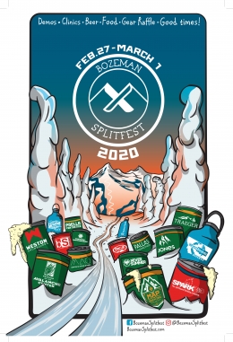
February 27 - March 1, Bozeman Splitfest, More info and schedule here.
March 4, 1-hr Avalanche Awareness. 6-7 p.m. at REI.
At the end of last season, Dan at Spark R&D interviewed Alex and Doug on their work at the GNFAC. He posted the 50-minute podcast HERE.


